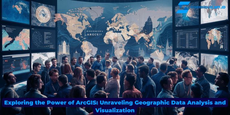
ArcGIS is a powerful tool that has revolutionized the way we analyze and visualize geographic data. Whether you are a GIS professional, a researcher, or a business owner, understanding the capabilities of ArcGIS can greatly benefit your work. In this article, we will delve into the intricacies of ArcGIS, exploring its features, applications, and the value it brings to various industries. Join us as we unravel the world of ArcGIS and unlock its potential for transforming the way we understand and interact with the world around us.
The Basics of ArcGIS
ArcGIS, developed by Esri, is a Geographic Information System (GIS) software that allows users to collect, manage, analyze, and visualize geographic data. It provides a comprehensive suite of tools and functionality for professionals across various industries, including urban planning, environmental management, disaster response, and market analysis.
Key Features and Capabilities
ArcGIS offers an extensive range of features and capabilities that make it a versatile and powerful tool for working with geographic data. Some of its key features include:
- Mapping and Visualization: ArcGIS enables users to create stunning maps and visualizations that effectively communicate spatial patterns and relationships. It supports a wide range of data formats and provides advanced symbology options.
- Data Management: With ArcGIS, users can efficiently organize and manage their geographic data. It allows for the integration of various data sources, such as satellite imagery, GPS data, and demographic data, into a centralized database.
- Geoprocessing: ArcGIS provides a robust set of geoprocessing tools that allow users to perform complex spatial analysis tasks. These tools include buffering, overlay analysis, network analysis, and spatial statistics.
- Geocoding and Routing: Users can leverage ArcGIS’s geocoding capabilities to convert addresses into geographic coordinates, facilitating accurate geospatial analysis. Additionally, it offers routing functionality for finding optimal routes and generating driving directions.
- Web GIS: ArcGIS supports the creation and sharing of web-based maps and applications. This allows users to collaborate, publish their work online, and access GIS data and tools from any device with internet connectivity.
Applications in Various Industries
ArcGIS finds applications in a wide range of industries, including:
- Urban Planning: ArcGIS aids urban planners in analyzing land use patterns, identifying suitable locations for infrastructure development, and simulating future growth scenarios.
- Environmental Management: It assists environmental scientists in monitoring and managing natural resources, tracking the spread of invasive species, and assessing the impact of climate change.
- Disaster Response: ArcGIS plays a crucial role in emergency management by providing real-time spatial information, resource allocation analysis, and creating evacuation plans.
- Market Analysis: Businesses can utilize ArcGIS to analyze customer demographics, identify potential markets, and optimize their distribution networks.
As we delve deeper into this series, we will explore these applications in more detail and uncover how ArcGIS continues to transform industries across the globe.
Getting Started with ArcGIS
Whether you are new to ArcGIS or have some prior experience with GIS software, it’s important to understand the steps to get started. Let’s explore the key components and resources that can help you embark on your ArcGIS journey.
1. Installing ArcGIS
The first step is to install ArcGIS on your computer. Esri provides different versions of ArcGIS software, including ArcGIS Desktop, ArcGIS Pro, and ArcGIS Online. Choose the version that best suits your needs and follow the installation instructions provided by Esri. Make sure to check the system requirements to ensure compatibility.
2. Learning the Interface
Once installed, familiarize yourself with the ArcGIS interface. Explore the different menus, toolbars, and panels. Get comfortable with navigating the map view and accessing the various tools and functionalities. Esri provides comprehensive documentation and tutorials to help you understand the interface and its features.
3. Accessing Data
ArcGIS offers a wide range of data sources that you can utilize in your projects. You can access publicly available data, such as satellite imagery, topographic maps, and demographic data, through Esri’s Living Atlas or other data portals. Additionally, you can import your own data from various file formats, such as shapefiles, CSV files, and geodatabases.
4. Learning Resources
Esri provides a wealth of learning resources to help you enhance your ArcGIS skills. Their website offers tutorials, videos, and webinars that cover a wide range of topics, from basic GIS concepts to advanced spatial analysis techniques. Take advantage of these resources to expand your knowledge and make the most of ArcGIS.
5. Joining the Community
Engage with the ArcGIS community to connect with fellow users, ask questions, and share your experiences. Esri hosts forums, user groups, and social media communities where you can interact with GIS professionals and enthusiasts. Participating in these communities can provide valuable insights and opportunities for collaboration.
By following these steps, you can kickstart your journey with ArcGIS and begin harnessing the power of spatial analysis and visualization. In the next section, we will explore some practical tips and tricks to help you make the most of ArcGIS in your projects.
Tips and Tricks for Maximizing ArcGIS
Now that you have a basic understanding of ArcGIS, let’s dive into some tips and tricks that can help you optimize your workflow and maximize the potential of this powerful GIS software.
1. Keyboard Shortcuts
Mastering keyboard shortcuts can significantly speed up your work in ArcGIS. Take the time to learn commonly used shortcuts for tools, navigation, and editing tasks. Esri’s documentation provides a list of keyboard shortcuts for different versions of ArcGIS, so make sure to familiarize yourself with them.
2. Customizing the Interface
ArcGIS allows you to customize the interface to suit your preferences and work style. You can rearrange toolbars, create custom menus, and save workspace configurations. Experiment with different interface setups to create a personalized environment that enhances your productivity.
3. Utilizing Model Builder
ArcGIS Model Builder is a powerful tool that enables you to automate repetitive tasks and create complex geoprocessing workflows. By visually connecting predefined tools and processes, you can build models that can be reused and shared with others. Explore the capabilities of Model Builder to streamline your workflows.
4. Leveraging Geoprocessing Tools
ArcGIS offers a vast array of geoprocessing tools that can perform various spatial analysis tasks. Take the time to explore and understand the capabilities of different tools, such as buffer analysis, interpolation, and proximity analysis. Knowing when and how to use these tools can greatly enhance your analysis and decision-making processes.
5. Exploring Extensions
ArcGIS provides several extensions that extend the core functionality of the software. Extensions like Spatial Analyst, 3D Analyst, and Network Analyst offer advanced tools for specific analysis needs. Consider exploring these extensions to unlock additional capabilities and expand the range of analyses you can perform.
6. Documenting Your Work
Documentation is essential for reproducibility and sharing your work with others. Take advantage of ArcGIS’s documentation features, such as adding metadata, creating map layouts, and generating reports. By documenting your work thoroughly, you can ensure clarity and facilitate collaboration with colleagues or stakeholders.
By implementing these tips and tricks, you can enhance your ArcGIS experience and become more proficient in utilizing its vast range of capabilities. In the next section, we will delve into advanced techniques and real-world examples of ArcGIS applications in different industries.
Advanced Techniques and Real-World Applications of ArcGIS
As you become more proficient with ArcGIS, you can explore advanced techniques and apply them to real-world scenarios. In this section, we will cover some advanced features and showcase examples of how ArcGIS is being used in various industries.
1. Spatial Analysis Techniques
ArcGIS offers a wide range of spatial analysis techniques that go beyond basic mapping and visualization. These techniques include spatial statistics, interpolation, network analysis, and suitability modeling. By mastering these techniques, you can gain deeper insights into spatial patterns and relationships, aiding in decision-making processes.
2. 3D Visualization and Analysis
ArcGIS enables the creation of stunning 3D visualizations and facilitates 3D analysis. Whether you are visualizing urban landscapes, exploring geological formations, or analyzing building heights, ArcGIS provides tools to work with 3D data and perform advanced analyses in three dimensions.
3. Remote Sensing and Image Analysis
ArcGIS integrates remote sensing capabilities, allowing you to work with satellite imagery and perform image analysis. You can extract valuable information from remotely sensed data, such as land cover classification, change detection, and vegetation indices. This integration opens up opportunities for environmental monitoring, disaster assessment, and agricultural analysis.
4. Real-Time Data Integration
ArcGIS supports real-time data integration, enabling you to incorporate live sensor feeds, GPS data, and social media feeds into your analysis. This capability is particularly useful for applications in emergency response, transportation monitoring, and social media sentiment analysis.
5. Industry Applications
ArcGIS finds applications in a multitude of industries:
- Healthcare: ArcGIS aids in healthcare planning, disease mapping, and resource allocation for hospitals and clinics.
- Transportation: It helps optimize transportation networks, analyze traffic patterns, and plan efficient routes for logistics and commuting.
- Utilities: ArcGIS assists in managing utility networks, analyzing power distribution, and identifying potential issues in infrastructure.
- Natural Resources: It supports the management of forests, water resources, and wildlife habitats, aiding in conservation and sustainable resource utilization.
- Government: ArcGIS is utilized by governments for urban planning, disaster management, land administration, and electoral mapping.
These are just a few examples of how ArcGIS is being applied across various industries. As new technologies emerge and GIS continues to evolve, ArcGIS remains at the forefront, empowering professionals to make informed decisions and solve complex spatial problems.
The Future of ArcGIS: Advancements and Trends
ArcGIS has come a long way since its inception, and as technology continues to advance, we can expect exciting developments and trends in the future of this GIS software. In this section, we will explore some of the key advancements and trends that are shaping the future of ArcGIS.
1. Cloud-Based GIS
Cloud-based GIS has gained significant traction in recent years, allowing users to access and analyze geospatial data from anywhere, anytime. ArcGIS has embraced this trend with its ArcGIS Online platform, which enables users to store, manage, and share their geospatial data and maps in the cloud. We can expect further enhancements and integration of cloud-based technologies in the future, making GIS even more accessible and collaborative.
2. Artificial Intelligence and Machine Learning
The integration of artificial intelligence (AI) and machine learning (ML) with GIS has immense potential. AI and ML algorithms can automate data analysis, identify patterns, and make predictions, revolutionizing the way we extract information from geospatial data. ArcGIS is already incorporating AI and ML capabilities into its tools, and we can anticipate further advancements in this area, enabling more accurate and efficient spatial analysis.
3. Augmented Reality and Virtual Reality
Augmented reality (AR) and virtual reality (VR) technologies are becoming increasingly popular, providing immersive experiences and new ways to interact with spatial data. ArcGIS is exploring the integration of AR and VR into its software, allowing users to visualize and analyze geospatial data in a more immersive and interactive manner. This opens up possibilities for applications in urban planning, tourism, and education.
4. Mobile GIS
With the proliferation of smartphones and tablets, mobile GIS has gained significant importance. ArcGIS has developed mobile applications that enable users to collect data, perform analysis, and access maps on the go. As mobile technology continues to advance, we can expect more sophisticated mobile GIS capabilities, empowering field workers and enhancing data collection and analysis in real-time.
5. Open Data and Collaboration
The trend towards open data and collaboration is reshaping the GIS landscape. ArcGIS supports the sharing and collaboration of geospatial data through its ArcGIS Online platform and open data initiatives. The future of ArcGIS will likely involve increased integration with open data standards, fostering collaboration among GIS professionals and enabling the exchange of information across organizations and sectors.
As ArcGIS continues to evolve, these advancements and trends will shape the future of GIS, enhancing its capabilities and expanding its applications. By staying updated with these developments, you can harness the full potential of ArcGIS and stay at the forefront of the GIS field.
In conclusion, ArcGIS is a powerful and versatile GIS software that has transformed the way we analyze and visualize geographic data. From its mapping and visualization capabilities to its advanced spatial analysis tools, ArcGIS has proven to be an indispensable tool for professionals across various industries.
As we have explored throughout this article, ArcGIS offers a range of features and functionalities that enable users to collect, manage, analyze, and visualize geospatial data effectively. Whether you are a GIS professional, a researcher, or a business owner, understanding the basics of ArcGIS and exploring its advanced techniques can greatly benefit your work.
We have also seen how ArcGIS finds applications in diverse industries, such as urban planning, environmental management, disaster response, and market analysis. Its broad range of industry-specific applications showcases the versatility and value that ArcGIS brings to different sectors.
Furthermore, we have discussed the future of ArcGIS, with trends such as cloud-based GIS, AI and ML integration, augmented reality, mobile GIS, and open data collaboration shaping the GIS landscape. Embracing these advancements will undoubtedly unlock new possibilities and enhance the capabilities of ArcGIS in the years to come.
In conclusion, ArcGIS continues to be at the forefront of GIS software, empowering professionals to make informed decisions, solve complex spatial problems, and gain valuable insights from geospatial data. By harnessing the power of ArcGIS and staying updated with its advancements, you can unlock a world of possibilities for spatial analysis, visualization, and collaboration.